|
|
Post by RKC on Oct 17, 2017 9:44:06 GMT 12
G'day, 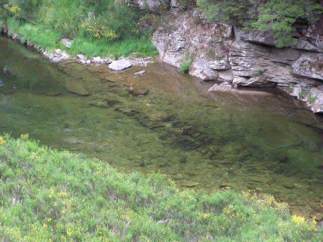 Wing dam at Canton on the Waikaia river, Old Man Range. 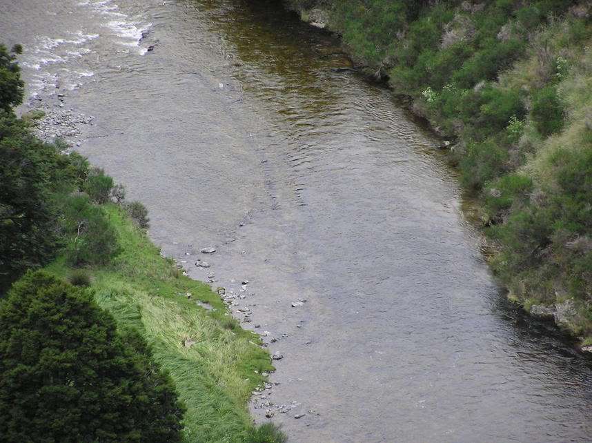 Wing dams in the Waikaia river. 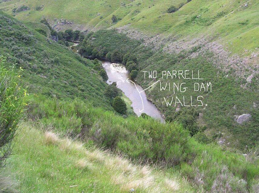 Same as above. 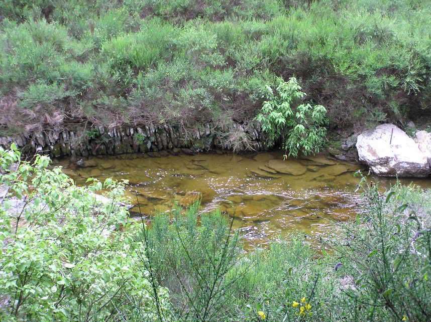 Wing dam wall near the junction of the right and left branches of the Waikaia river, Old Man Range. 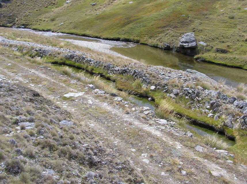 Wing dam wall on the Old Man Range. 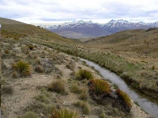 Old miners water race now being used for irrigation. Regards, Rob (RKC) |
|
|
|
Post by eoinc on Dec 6, 2017 10:06:22 GMT 12
Thank you for this excellent series of pages, Rob. Are those the Garvie Mountains in the background (snow-covered)?
Cheers,
Eoin
|
|
|
|
Post by RKC on Dec 6, 2017 19:10:32 GMT 12
G'day Eoin,
I think that the Garvie Mountain Range is a little further south than where the photo above, showing a water race, is located. The Mountains in that photo could be Hector Mountains looking across the Nevis Valley.
The photos were taken some years back, and importantly, I was not using a GPS then. I put off using a GPS until a few years ago as I though using a GPS unnecessary. How wrong I was! I now regard using a GPS as essential when going bush. Only yesterday I had turn on the GPS to find out where I was, and it saved me hours by showing me the quickest and easiest way out.
Good to learn you enjoyed the photos of what is a remarkable and unique part of Otago.
BTW: In a post earlier in this thread I made a mistake with a place name (which I have now corrected). I referred to Anderson Flat when I should have written Moonlight Flat. At the time the post was first written I tried to check the place name on Google maps, but it was unnamed on Google Maps. I relied on my memory alone ... and thus a mistake was made.
Regards,
Rob (RKC)
|
|
|
|
Post by eoinc on Dec 7, 2017 1:34:49 GMT 12
Thanks, Rob. A useful tool in this 'App-laden' World is Maptoaster (digital topographic NZ maps) www.maptoaster.com/maptoaster-topo-nz/index.html which look the same as my 1:50,000 paper topo maps. A bit off topic, but this area of Otago is dear to me (although I'm currently living in Malaysia). My family is from Southland / Otago and a lot of my growing up was in Frankton. My Father was big on the great outdoors, so much of our free time was spent tagging on to his back-block excursions, including the Nevis area. I'll see if I can dig out an account by my Great Grandfather of when he drove a bullock train from Otokia to Kingston, bringing in supplies for the Miners. My aim is to head back down there, and to return to some of the back-Country. Here's me 'co-Captaining' the Earnslaw with Capt. Pat McSoriley, who grew up at Macetown (his father was a Miner, and the remains of his house were the first building you came across, as you walked in), and was my Mum's 2nd cousin, or some such... 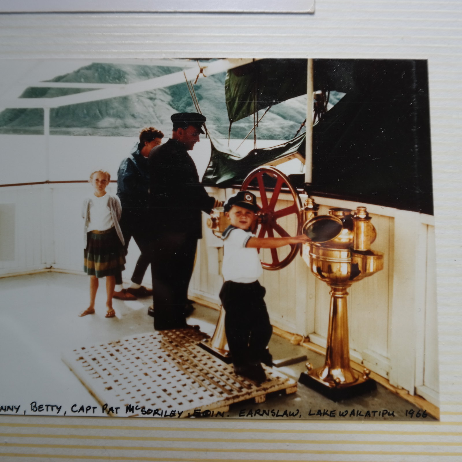 Earnslaw-Eoin, Jenny, Betty& CaptnPat 1966 Earnslaw-Eoin, Jenny, Betty& CaptnPat 1966 by Eoin Christie, on Flickr Cheers, Eoin |
|
|
|
Post by mardimu on Jan 16, 2018 20:33:25 GMT 12
My husband has an interesting story of his 'getaway' to the Old Man Range
in the 80's (which could have been another life lost there)
Is it ok to share it on this forum? I'll ask him as well...
I love the photos here, which give me more of an idea of the terrain he
described. 'Lord of the Rings' scenery?
Garth turns 80 next week, and is currently writing his memoirs...
|
|
|
|
Post by boaraxa on Jan 19, 2018 14:05:25 GMT 12
Sounds like an interesting storey post away  |
|
|
|
Post by eoinc on Jan 23, 2018 18:31:33 GMT 12
Please do post. Stories exist for telling.
|
|


