|
|
Post by boaraxa on Jan 23, 2013 11:21:43 GMT 12
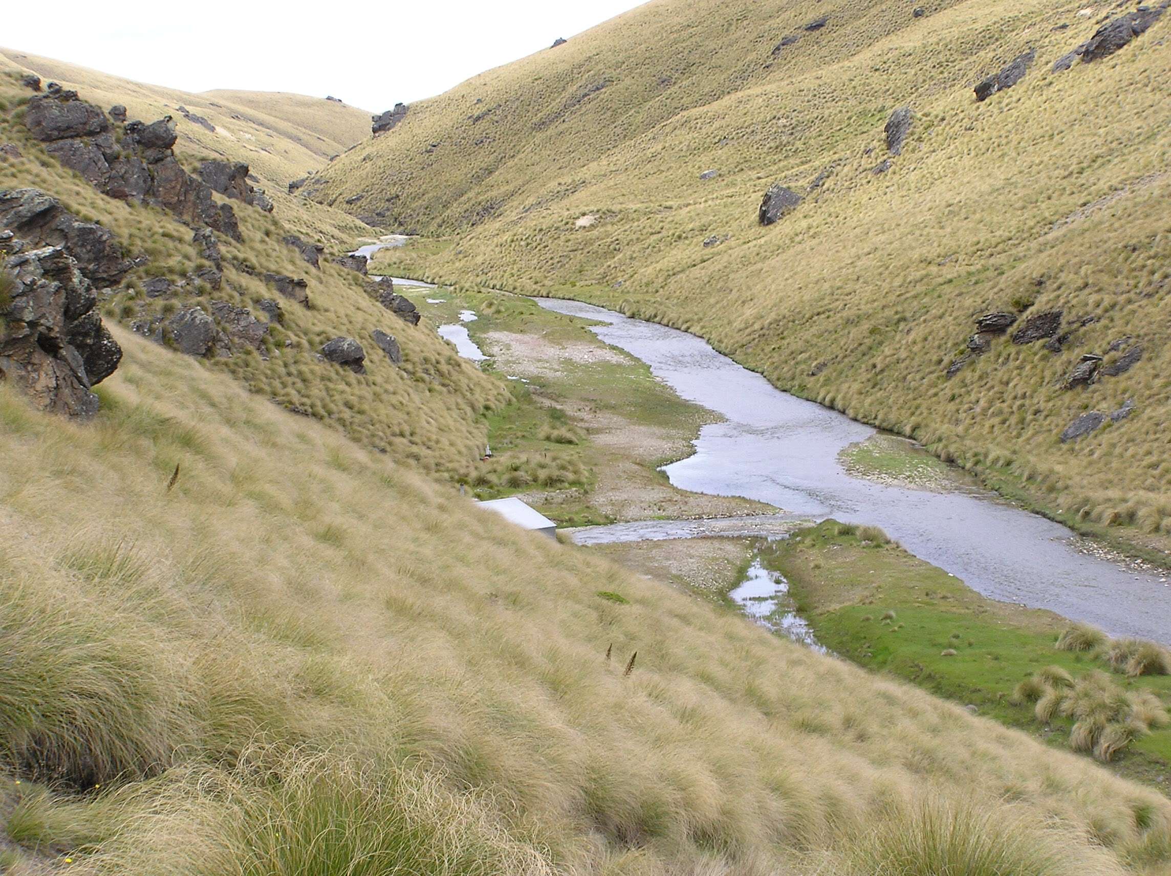
Hi Rob
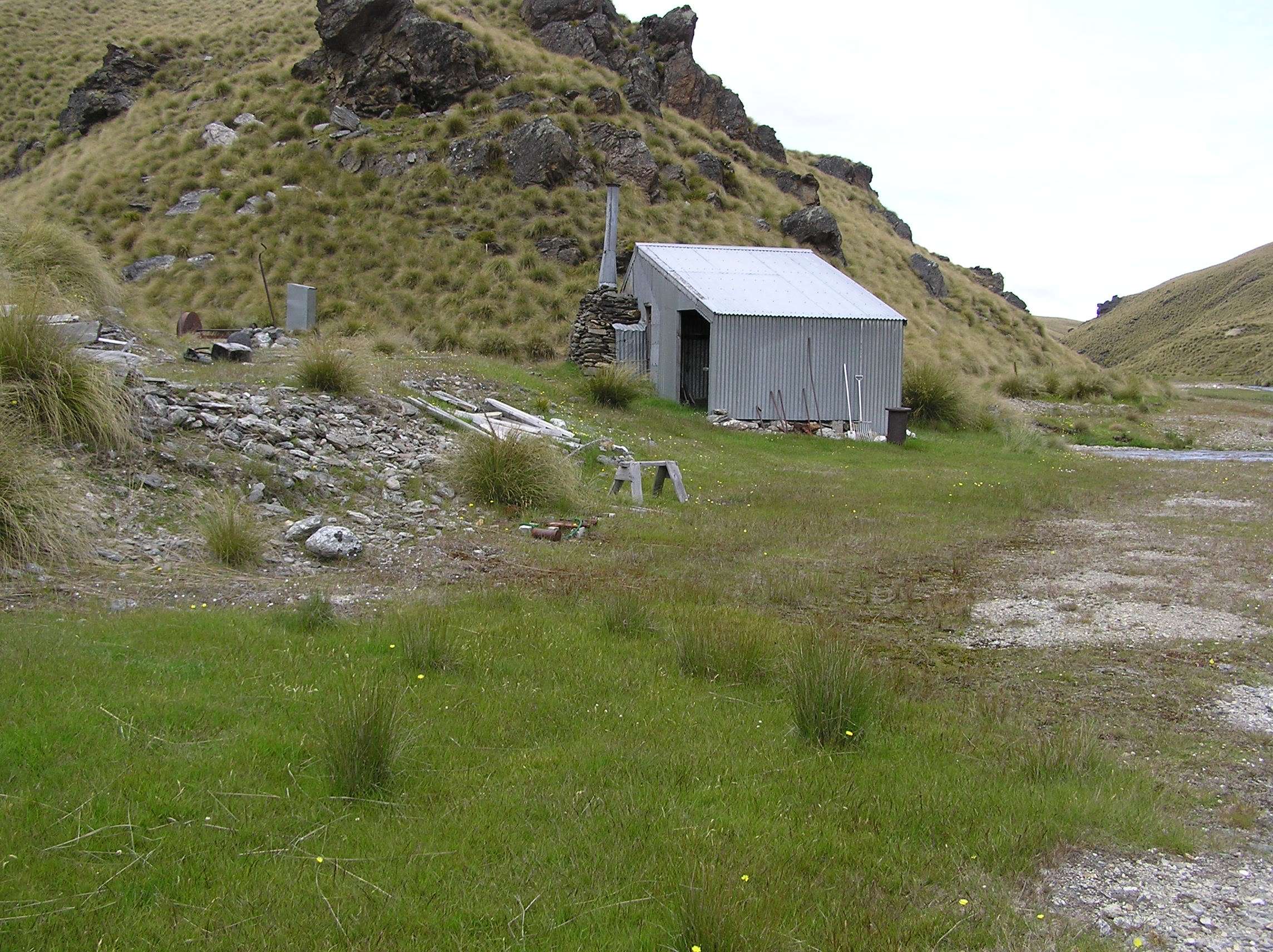
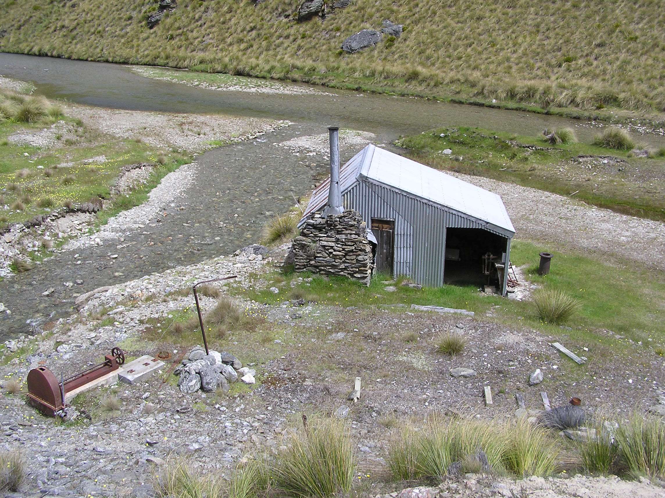
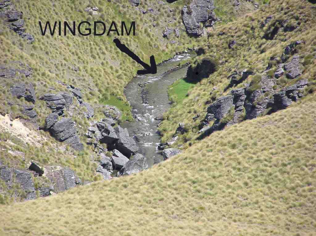
That's a good point would make sence if that was made in the 1930,s....if u look closely u can see it extends upstream as well but has been mostly washed away.
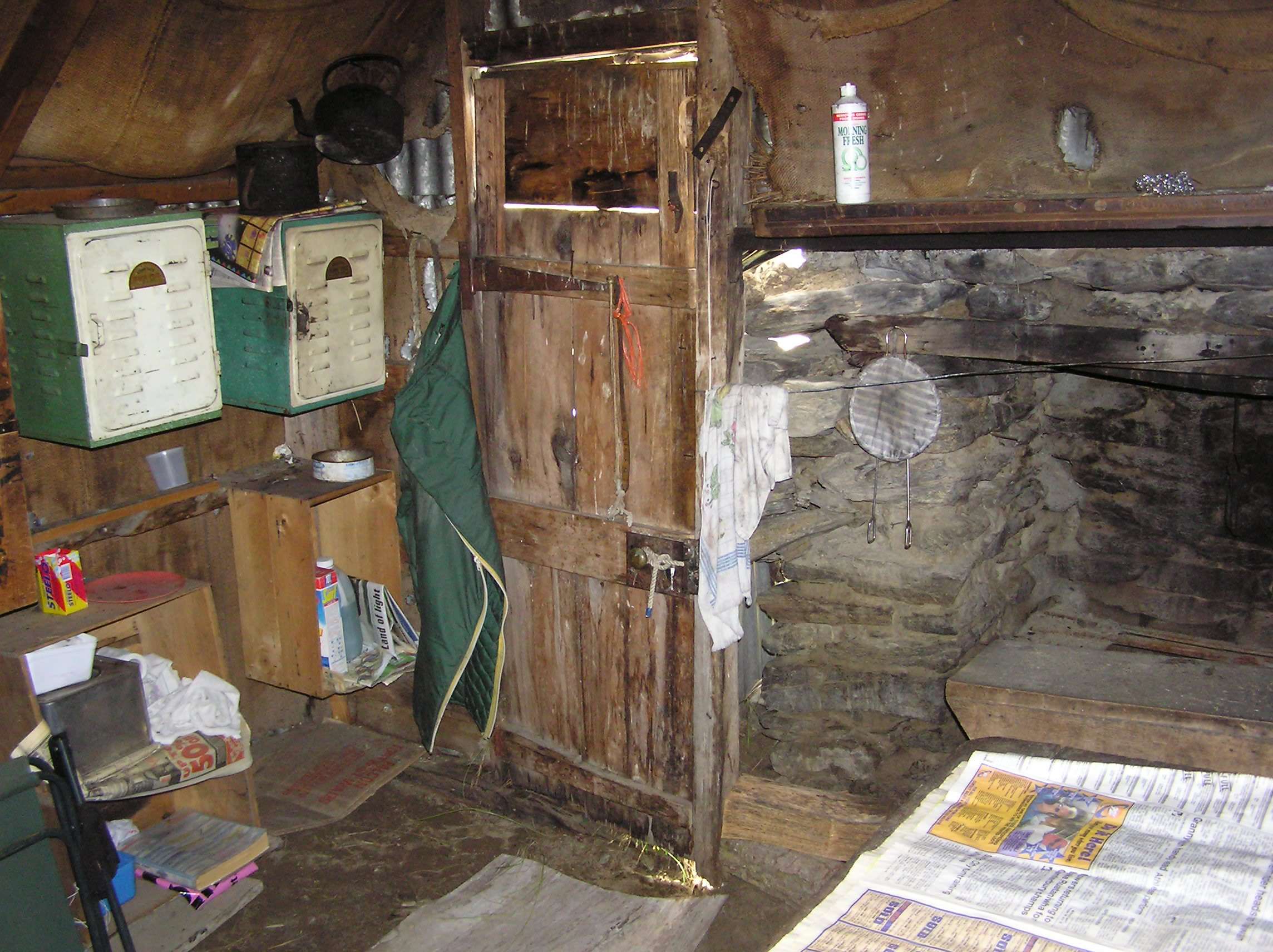
I would like to find out a bit more info on the place of more recent mining activity but seems its a bit unknown I spoke to a fella who dredged it years ago but that was many k,s down stream this area I've taken a few pic,s off is very remote.
|
|
|
|
Post by RKC on Jan 23, 2013 14:19:21 GMT 12
G'day boaraxa,
I very much doubt any archeologist could determine conclusively if any remaining Otago wing dams were from the 1880s or from the 1930s, as exactly the same method was employed in their construction during each period of mining activity. If an archeologist ever tries to tell you a wing dam was definitely from the 1800s, he is bluffing. If there are remains on the stream bank, such as galvanized iron roofing material, that can be determined as not from the 1800s, then it's reasonable to conclude that the wing dam walls would likely be from the 1930s.
In the "New Zealand Journal of Archaeology, 1981, Vol 3, page 68." it had the following to say about wing dams in Central Otago ... A notable feature of Chinese alluvial mining in Central Otago was the use of low vertically stacked stone walls (wing dams) to deflect the flow of the river or stream to one side of its channel. If the angle of the stone alignment was acute to the flow, this caused the opposite bank to be undercut. If, however, the structures were built at or near parallel to the flow they enabled the creek or river, to be deflected to one side of the channel whilst the other side was dry-worked. Chinese wing dams in Central Otago were typically constructed of slabs of schist placed vertically in long lines in the described alignments. They were not defined here as tailings because they served principally as defectors or retaining walls. In some instances the stone used in their construction was carried some distance to the mining site. Their durability is attested by the fact that many have survived massive floods and still exist intact today.
Many modern miners are finding wing dams, constructed by bulldozer and excavator, to be a cost-efficient method of working river gravels. The impounded areas are pumped dry after which the gravels are mechanically excavated and passed through a rotary screen and sluice-box to retrieve the gold. The unconsolidated gravels which form the modern wing dams are eventually washed away by high river flows.
I've never made it into the area of your claim where the photos were taken. I've been in the far upper reaches, where there are massive old river bank workings, and I've been lower down, where there are some really interesting stacked tailings (the declared historical area). The area where you took the photos look to me as a gold dredgers nirvana ... if it was me I'ed be moving heaven and earth to get the paperwork done as quick as possible so I could get in there and have some fun (profitable fun!).
Regards,
Rob (RKC)
|
|
|
|
Post by powderburns on Feb 1, 2013 21:24:20 GMT 12
From potters creek to Adelaide point was diverted and mined by a party from 1864 to 1899. 40 years!
Flood races in bedrock, flood races on riverbed, tunnels! Over 2 km!
Try John mccraws, gold on the dunstan, chapter 2.
I bow down before these men's labours. Awesome.
Good luck with the claim
|
|
|
|
Post by RKC on May 25, 2016 14:56:40 GMT 12
|
|
|
|
Post by RKC on May 27, 2016 10:37:39 GMT 12
G'day, Waikaia Bush Road to remain openThe alpine road where 38 four wheel drive enthusiasts were trapped in snow drifts and blizzard conditions on Sunday night will remain open until Queen's Birthday weekend.
Waikaia Bush Rd, which runs from Piano Flat in northern Southland to Shingle Creek in Central Otago, will be closed as normal at the southern end at Queens Birthday weekend and reopen at Labour Weekend.www.stuff.co.nz/southland-times/80429377/waikaia-bush-road-to-remain-openRegards, Rob (RKC) |
|
|
|
Post by RKC on Jun 6, 2016 11:27:02 GMT 12
|
|
|
|
Post by RKC on Jun 6, 2016 11:28:33 GMT 12
|
|
|
|
Post by jbmurc on Aug 31, 2016 19:48:09 GMT 12
Yes stunning area ....have been trail riding all across the Oldman-Old woman -Carrick ranges -for the last 20yrs with mates ... one of my favourite rides is from bannockburn/carricktown to Obelisk rock around 100-120kms in total.....just the other week I was riding around the Cairnmuir ranges above Cydle .... much respect must be given.... when the weather drops and your vis is down to a few meters it sure is good feeling to get off the high ranges
|
|
|
|
Post by RKC on Sept 1, 2016 14:11:34 GMT 12
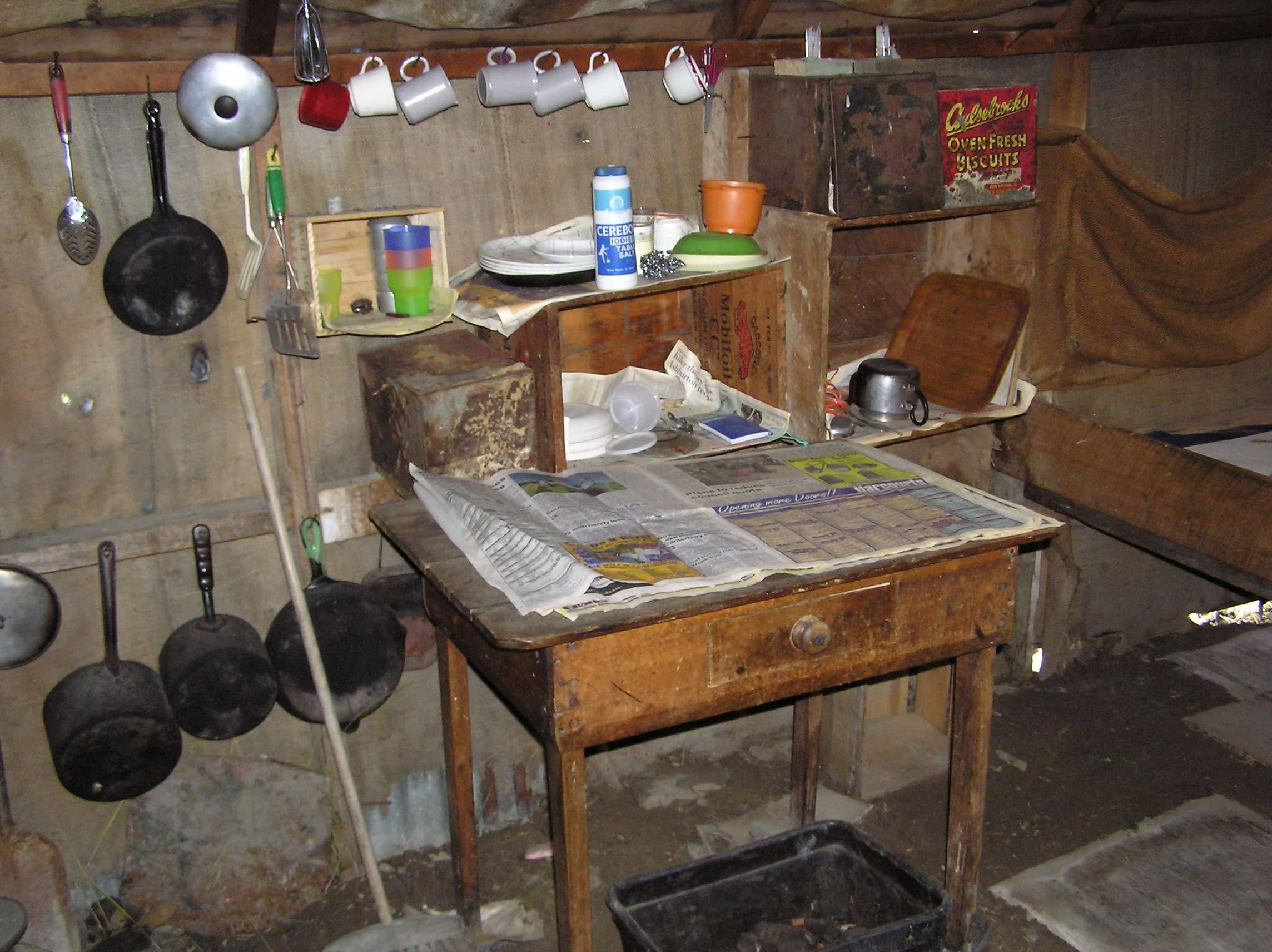
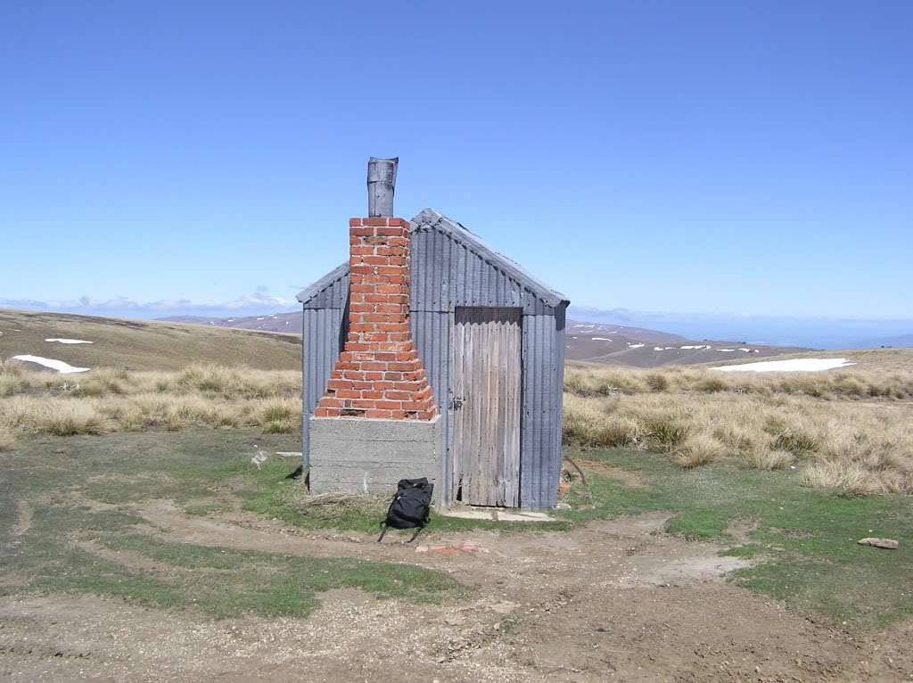
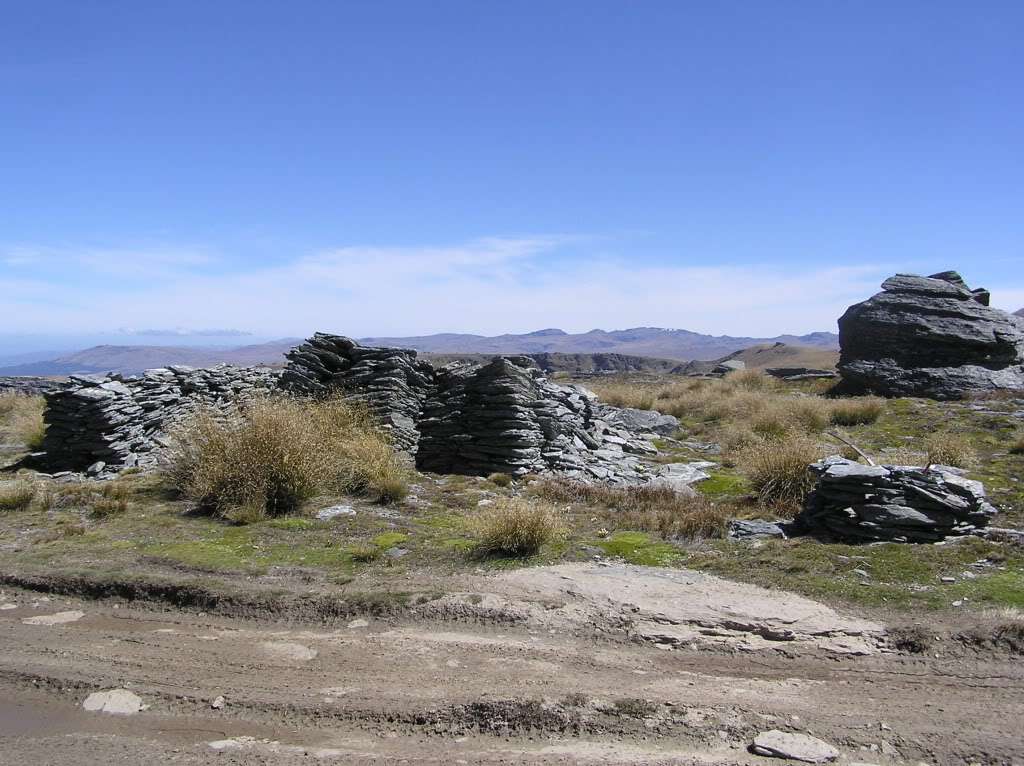
Yes stunning area ....have been trailing riding all across the Oldman-Old woman -Carrick ranges -for the last 20yrs with mates ... one of my favourite rides is from bannockburn/carricktown to Obelisk rock around 100-120kms in total.....just the other week I was riding around the Cairnmuir ranges above Cydle .... much respect must be given.... when the weather drops and your vis is down to a few meters it sure is good feeling to get off the high ranges G'day jbmurc, All across the Old Man, and Old Woman, ranges are great recreational opportunities these days. DOC did a great job getting the area opened up for public access. Prior to access being freed up, anyone wanting to go up there had to get written permission from each leaseholder, which could take months. And it only took one cranky farmer to refuse access and the trip was off. Allowing access has seemed to have worked well up there. An abandoned old miners hut on the Old Man Range ... 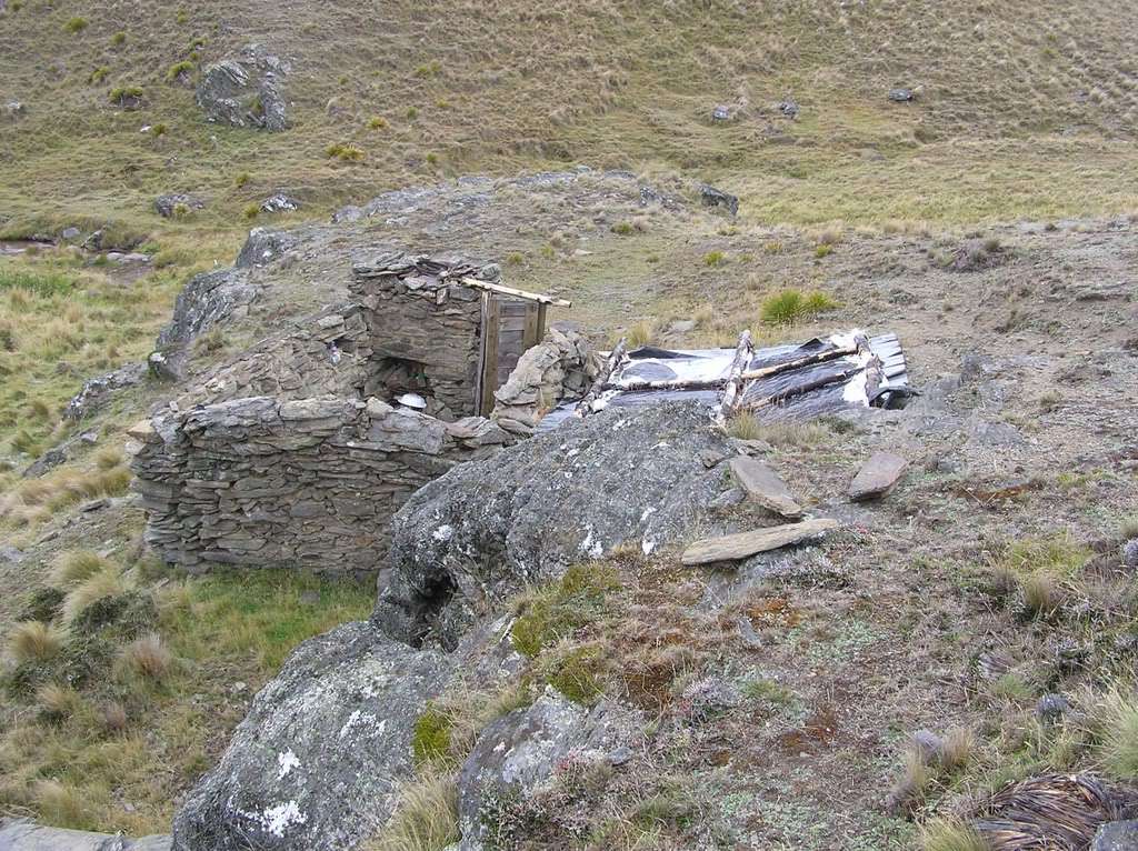 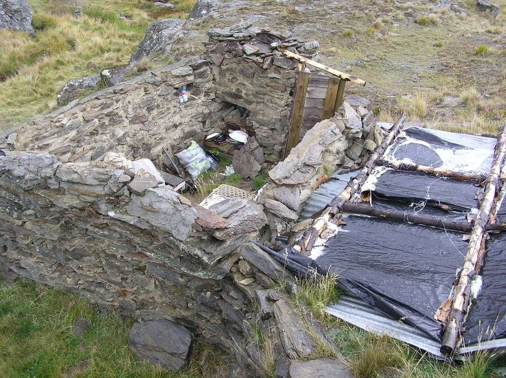 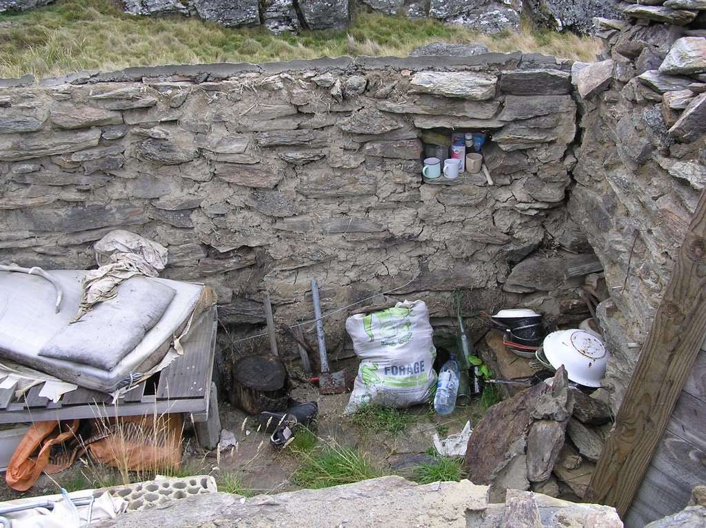 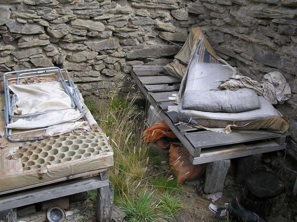 Regards, Rob (RKC) |
|
|
|
Post by RKC on Sept 1, 2016 14:23:37 GMT 12
G'day, Old Woman Range ... 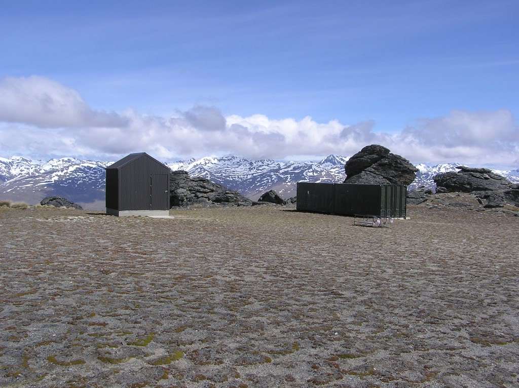 I wonder when the PC Nazis are going to want to change the name of the Old Woman Range to a non-gender specific name! Regards, Rob (RKC) |
|
|
|
Post by RKC on Sept 3, 2016 13:15:45 GMT 12
|
|
|
|
Post by nilecat on Oct 24, 2016 15:23:20 GMT 12
Gday Rob, it's been awhile since I've been in GDF and reading your last few pages here and the comments of others about that area has my mind in a whirl as to how those guys could exist let alone work in such a barren remote place. I don't see any trees handy so they would have to bring in wood plus everything to keep them alive let alone the strength to work their claim. What super men they were. And yes I agree with all the data and knowledge you have gained over the years, that you should write that book
|
|
|
|
Post by RKC on Oct 25, 2016 10:01:53 GMT 12
G'day nilecat,
The barren treeless tussock-grassland landscape that covers the Old Man Range was actually typical of the landscape covering nearly all of inland Otago at the time of the first gold rush in the 1860s. Back then even the lowland areas such as around present day Alexandria and Queenstown, was nearly all tussock grassland with very few trees. It was a significant problem for the first gold miners to find enough wood to construct sluice box's, and so on. There was one patch of trees near present day Wanaka that the miners quickly cut down and transported to the gold fields (at inflated prices to reflect the scarcity of wood). And during the very early days of the rush, wood was far too valuable to burn.
Inland Otago must have been a very bleak place in the 1860s. Even the Maori's found it uninhabitable and they had only very few, and small, settlements. Their main use of the area was to travel through in summer to get to the fertile West Coast for the abundant seafood, and for Pounamu.
The 1860s were a time when capitalism and the industrial revolution was changing the world for the better, when men had learned how to adapt the environment so they could survive and prosper, rather than being entirely at the mercy of a severe environment.
Regards,
Rob (RKC)
|
|
|
|
Post by powderburns on Oct 26, 2016 20:51:33 GMT 12
G'day guys, just back from hiking into old Macetown along the goblin trails in the mountains. Then back along the Arrow. Saw quite a few trees felled with 2ft round bases. Amongst the snow ravaged trees. Bet the gold rush miners would have paid a pretty penny for the timber. How upside down have we gotten that the trees are now a pest. Old Skippers too is now a wilding pine dead waste land. A scene from Dante's inferno, just waiting for a match. The old orchard at the hotel has been hit with agent orange and now is only a memory. Get out and look at Otago if you can, before our industrial heritage is gone. I'm more convinced than ever that the recycling god so many people worship is a perverted evil thing.
|
|
|
|
Post by RKC on Oct 12, 2017 9:08:11 GMT 12
|
|